











For smart lighting GIS integration, a geographic information system (GIS) should provide the spatial reference for a streetlight, a computerized maintenance management system (CMMS) should govern maintenance work and closure, and 311 should capture and communicate service requests. Connecting those roles with a persistent asset identifier and defined status handoffs creates a traceable path from a reported issue or lighting event to documented field work.
For cities and transportation agencies, the integration question is not simply whether systems can exchange data. The practical question is whether staff can identify the same asset in every system, decide who owns each update, and resolve exceptions without leaving residents, dispatchers, or field crews with conflicting information.
Key takeaways
- Give GIS, the CMMS, and 311 distinct system-of-record responsibilities rather than asking one platform to replace the others.
- Use a persistent agency asset ID to connect a map feature, connected-lighting record, service request, and work order.
- Define status mappings, ownership, exceptions, and reconciliation before automating a data exchange.
- Pilot one bounded service workflow and measure its data quality before extending the approach across the network.
FIELD WORKFLOW
From a streetlight report to a verified closeout
An example handoff for agencies to define and test; actual integrations depend on system configuration and policy.

Why streetlight service workflows lose context
A streetlight issue can begin with a resident report, a field observation, or a connected-lighting event. Each starting point may describe the same physical asset differently: an intersection description from a resident, a coordinate from a map, a controller identifier from a lighting platform, or an asset tag in a work order.
That variation is manageable when staff can reconcile it deliberately. It becomes difficult when a report is routed to maintenance without a reliable asset match, when a work order closes without updating the relevant service request, or when an asset replacement changes an identifier without a documented cross-reference.
These are not universal failures, and they are not evidence that any particular platform is inadequate. They are design questions an agency should address when connecting smart lighting, GIS, a CMMS, and 311 service systems.
Treat the systems as complementary records
GIS is well suited to maintaining the spatial context of roadway assets. In Esri's description, a geodatabase holds geographic datasets and uses feature classes, attributes, spatial relationships, and transaction workflows to manage geographic information. That makes it a useful reference for an asset's mapped location and selected attributes, but it does not make it a replacement for a maintenance work-history system. Esri's geodatabase overview describes the underlying data model.
A CMMS is generally the operational record for maintenance work: the request that became a work order, assignment, field activity, completion record, and applicable history. A 311 or service-request system is generally the intake and communication layer for reports from the public. The precise configuration varies by agency, policy, and software environment, so the following is a recommended operating model rather than a universal product architecture.
| System | Recommended primary role | Records it should reference |
|---|---|---|
| GIS | Spatial asset reference | Agency asset ID, mapped location, location-confidence status, and selected asset attributes |
| CMMS | Maintenance work system of record | Work order, assignment, maintenance status, work history, and applicable completion information |
| 311 or service system | Constituent intake and communication | Service-request ID, reported location and description, linked asset/work-order reference, and public-facing status where agency policy permits |
This division gives each team a clearer question to answer. GIS staff can maintain location and spatial relationships. Operations staff can govern work execution and closure. Service-center staff can manage intake and communication. An integration can then exchange references and status rather than create competing copies of every record.
Start with a shared streetlight asset identity
The most useful connection is usually a persistent agency asset ID. It is not the same as every other identifier in the workflow.
- An asset ID identifies the physical roadway-lighting asset in the agency's asset-management model.
- A GIS feature ID identifies a map record and may change if data is migrated or edited.
- A controller or network ID identifies a connected device or record in a lighting-management environment.
- A service-request ID identifies a particular report or interaction.
- A work-order ID identifies a maintenance transaction.
Keeping native IDs is important. Each has a legitimate purpose in its originating system. The integration design should instead maintain a governed cross-reference, with the persistent asset ID as the common business key when the agency can establish one.
For example, a resident may report “the light near the northbound bus stop is out.” The request itself should retain its own service-request ID and original description. A GIS match process can associate the report with a candidate asset, while preserving a flag if the match is uncertain. If maintenance work is needed, the CMMS can create or associate a work order without overwriting the original report or treating the work-order number as the asset identity.
Build a practical data contract
Before selecting an interface or configuring automation, define the minimum fields and their owners. The exact schema will vary, but an agency can use this checklist to begin the discussion.
| Field or reference | Why it matters | Recommended owner |
|---|---|---|
| Persistent asset ID | Joins records across systems | Asset-data governance owner |
| Location reference and confidence | Distinguishes verified matches from approximate reports | GIS/data steward |
| Asset lifecycle status | Shows whether an asset is active, removed, or replaced | Asset-data governance owner |
| Controller or network ID, when applicable | Associates a connected-lighting record without treating it as the asset ID | Connected-lighting operations owner |
| Service-request ID | Preserves the intake record and communication trail | 311/service-system owner |
| Work-order ID and work status | Connects maintenance execution and closure | CMMS owner |
| Timestamps and source system | Supports reconciliation and troubleshooting | Each originating system |
The team should also define how it will handle asset replacements, split or merged records, and assets that cannot be identified confidently. A replacement luminaire, for instance, may inherit a location but not necessarily every device or controller identifier. A documented cross-reference rule is safer than assuming all identifiers remain valid indefinitely.
Design the report-to-close handoff
A useful streetlight CMMS workflow can be expressed as a sequence of controlled handoffs. The sequence below is a design pattern, not a claim that any named product performs these steps automatically.
- A resident report, field observation, or connected-lighting event is received.
- The originating system stores its native event or service-request ID, description, time, and available location information.
- GIS or a governed matching process resolves the likely asset reference. Ambiguous matches enter a review queue rather than being silently assigned.
- Defined rules check whether an existing request or open work order already covers the issue.
- Eligible issues create or associate a CMMS work order, where maintenance operations govern assignment and execution.
- Field activity updates the work order. Asset attributes are updated only through the agency's documented data-governance process.
- A defined closure status returns to the service system using the linked record reference and the agency's communication policy.
- Reconciliation identifies open, failed, unmatched, duplicate, or contradictory records for follow-up.
This approach avoids a common ambiguity: a closed work order is not automatically proof that every related record has been updated. The integration needs an explicit definition of what “closed” means in each system and which status, if any, is appropriate to display to a 311 requester.
Make exceptions first-class workflow states
The integration should not treat every request as a clean, one-to-one asset match. An exception process is especially important for streetlight reports because location descriptions can be incomplete, an asset may have been replaced, or more than one request may refer to the same condition.
| Exception | Practical handling question |
|---|---|
| No asset found | Who verifies the location or determines whether a new asset record is needed? |
| Multiple likely assets | Who reviews the candidate match before work is dispatched? |
| Duplicate report | Which record remains the communication record, and how are related requests linked? |
| Asset replacement | Which IDs are retained, retired, or cross-referenced? |
| Integration failure | Where is the failure visible, and who owns retry or manual recovery? |
| Offline controller or missing event | Is the issue a device-communication condition, a reported lighting condition, or both, and who verifies it before dispatch? |
| Jurisdiction mismatch | How is the report routed without implying responsibility for another agency's asset? |
Assigning an owner and a disposition to each exception prevents the integration from hiding uncertainty behind a successful-looking data transfer.
Choose integration rules before choosing automation
An agency may ultimately use event-driven messages, scheduled synchronization, manual review, or a combination. The right choice depends on the available interfaces, the quality of source data, operating hours, governance rules, and the risk of acting on an incorrect match. It should not be inferred from a generic smart-lighting claim.
Start by documenting the rules in plain language:
- Which system is authoritative for each field?
- What event is eligible to create a work order, and what events require human review?
- Which statuses map across systems, and which remain internal to operations?
- Is the exchange one-way, bidirectional, or limited to linked references?
- How are failed messages, duplicate updates, and delayed updates detected and resolved?
- Who approves changes to field mappings, status definitions, and routing rules?
- What audit trail will show who changed a linked record, status, or asset reference?
- What is the minimum data needed for the handoff, and which fields should not be exchanged?
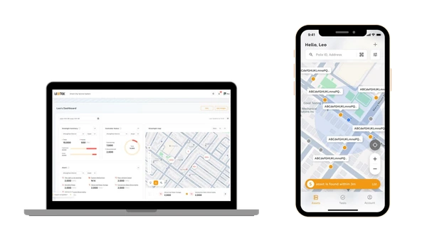
This preparation matters even when a connected-lighting platform supplies operational data. LEOTEK describes its LEOLink intelligent lighting system as supporting connected-lighting functions including remote operations, schedules, fault notifications, energy tracking, maps, reporting, alarms, and asset management. LEOTEK also presents RenAI roadway infrastructure management as a cloud-based roadway and streetlight-management platform with controller integration, fault detection, reporting, asset management, and AI assistance.
Those first-party descriptions can help a team frame the information it may need to govern. They do not establish compatibility with a particular GIS, CMMS, or 311 product, and they do not establish response-time, cost, or maintenance outcomes. Confirm interface availability, data handling, security controls, and project-specific requirements with the agency and the relevant vendors before implementation.
Bring the right teams into the design review
The workflow is stronger when GIS, field operations, maintenance planning, IT, the service center, and procurement can answer the same operational questions. A short design-review agenda can include:
- Who can create, edit, retire, and replace an asset record?
- What minimum location information is needed to match a report to an asset?
- Which issue types can create a work order, and which must be triaged first?
- Which work statuses may be communicated externally?
- What is the fallback process if a feed is delayed or unavailable?
- What evidence is required to consider work complete?
The resulting decisions should be tested against actual records, not only a diagram. That keeps field operations and service communication aligned with the data model.
Pilot the workflow and measure data quality
Begin with a bounded pilot, such as one district, one maintenance team, or one issue category. A pilot is an opportunity to test the quality of the handoff rather than to promise a result before the data and processes are proven.
Agency-defined measures can include the percentage of records that match a known asset, the age of unmatched requests, duplicate-report rate, completeness of service-request-to-work-order linkage, and the number of status-sync exceptions. These are diagnostic measures, not universal performance targets. The agency should decide its own definitions, baseline, and acceptable thresholds.
Review a sample of completed records from end to end. Can a service representative locate the request? Can a GIS analyst identify the associated asset and location status? Can a maintenance supervisor see the related work order and completion evidence? If those answers differ across systems, the next iteration should refine the data contract or exception rules before scaling.
Use connected-lighting evaluation to ask better integration questions
For a city or transportation agency evaluating connected lighting, the immediate task is to turn integration needs into verifiable questions. Request current documentation for the proposed configuration, identify the records to be exchanged, and confirm who will govern identifiers and status mappings after deployment.
The LEOTEK technical documents hub is a relevant starting point for reviewing available product and technical materials. It is not proof of a specific interface, integration, document revision, or project fit. Agencies should validate the applicable documentation, data-governance approach, and procurement requirements for their own environment.
A durable asset reference, accountable record ownership, and controlled status handoffs give a streetlight work-order integration a practical foundation. Test those controls against real records in one bounded workflow before extending them across the network.
Frequently asked questions
What is the difference between GIS and a CMMS for streetlights?
GIS is commonly used as the spatial reference for an asset's location and related map information. A CMMS is commonly used to manage maintenance work, including work orders and completion records. An agency may connect the systems, but it should define which system owns each field rather than duplicate records without governance.
Can a 311 streetlight integration automatically create a streetlight work order?
A 311 streetlight integration can be designed to create or associate a work order where agency rules and verified interfaces support that workflow. Before enabling it, define how duplicate reports, unclear locations, non-agency assets, and existing open work orders will be handled. Some requests may require review before a work order is created.
Which ID should connect GIS, CMMS, and 311 records?
A persistent agency asset ID is a practical common business key when one can be established. Keep the GIS feature ID, controller ID, service-request ID, and work-order ID as their native references, and maintain a documented cross-reference among them.
What should agencies validate before integrating smart lighting data?
Validate system-of-record ownership, asset and location data quality, available interface documentation, status mappings, exception handling, change control, data-governance responsibilities, and pilot acceptance criteria. Confirm project-specific security, privacy, procurement, and operational requirements with the appropriate agency teams and vendors.
References
- Esri, What Is a Geodatabase?.
- LEOTEK, LEOLink Solutions.
- LEOTEK, RenAI AI Roadway Infrastructure Management System.
- LEOTEK, Resources and Documents.